2014-2015 Map Contest Projects
The projects shown below were chosen as winners from the over 60 entries submitted by students in the 2014-2015 Geospatial Semester.
1st Place
Providing Drone Based WiFi to Remote Areas of Africa-Ryan Dixon, Freedom High School, South Riding, Virginia (Teacher: Ms. Katelyn Chadwick)
2nd Place
Distribution of Red-Eyed Vireos-Cady van Assendelft, Shenandoah Valley Governor's School, Fishersville, Virginia (Teacher: Ms. Jo-el Nelson)
3rd Place
Potholes: Conditions of Major Roads in Sterling, VA-Henry Hall and Kaitlyn Kocher, Dominion High School, Sterling, Virginia (Teacher: Ms. Laurie Gould)
Honorable Mention
The Accuracy of Raster Data-Tree Height Study in Prince George, Virginia- Josie Coleman, Colonial Heights High School, Colonial Heights, Virginia (Teacher: Mr. Bill Ryan)
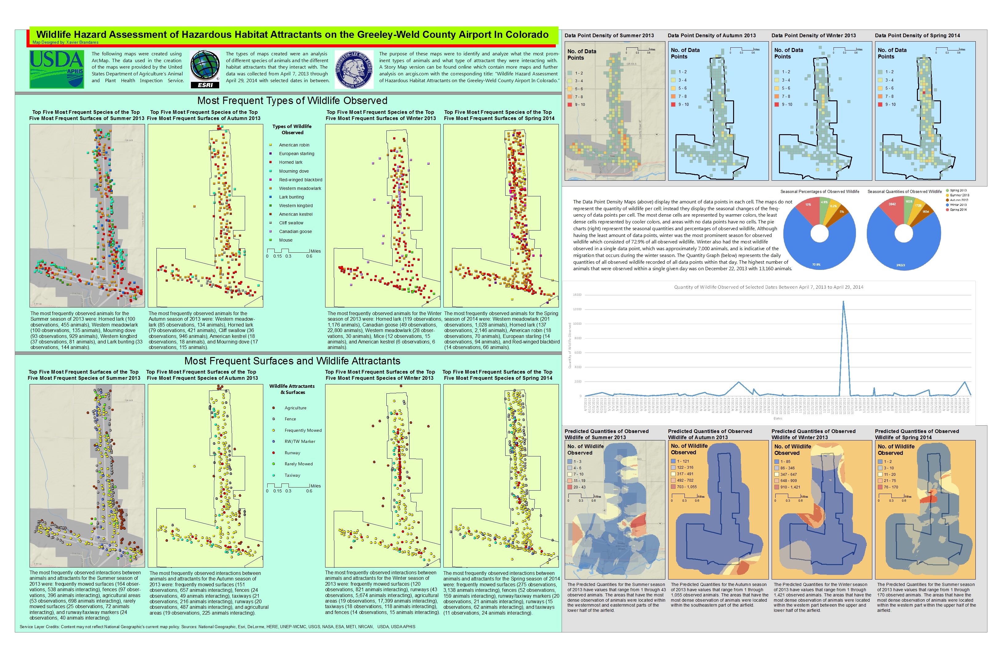
Wildlife Hazard Assessment of Hazardous Habitat Attractants on the Feeley-Weld County Aiport in CO-Xavier Brandares, Washington- Lee High School, Arlington, Virginia (Teacher: Mr. Ryan Miller)
Wind Resources in Montana-John Westenhoff & Jonah Shahid, South Lakes High School, Reston, Virginia (Teacher: Mr. Jon Pruess)


